
Société Holding dans le Loiret (45)
799 holdings sont référencées dans le département du Loiret
Vous recherchez une holding dans le Loiret ?
Le département Loiret représente 24% des holdings en Centre-Val-de-Loire.
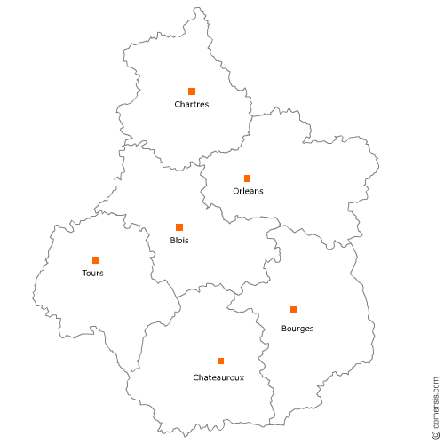
C'est le secteur d'Orléans qui compte le plus de holdings dans le 45.
C'est le secteur d'Orléans qui compte le plus de holdings dans le 45.
Le département du Loiret est découpé en différents secteurs géographiques qui regroupent chacun un ensemble de communes
Secteur d'Orléans
Indice d'implantation
| Commune | Nb Pro | Habitants | Distance | |
|---|---|---|---|---|
| Orléans - 45000 | 173 | 114375 | 0,0 | km |
Secteur de Saran
Indice d'implantation
| Commune | Nb Pro | Habitants | Distance | |
|---|---|---|---|---|
| Saran - 45770 | 42 | 15449 | 0,0 | km |
| Ormes - 45140 | 16 | 3725 | 4,7 | km |
Secteur de Beaugency
Indice d'implantation
| Commune | Nb Pro | Habitants | Distance | |
|---|---|---|---|---|
| Beaugency - 45190 | 8 | 7519 | 0,0 | km |
| Tavers - 45190 | 3 | 1357 | 2,5 | km |
| Messas - 45190 | 1 | 871 | 3,4 | km |
| Villorceau - 45190 | 1 | 1154 | 3,4 | km |
| Baule - 45130 | 2 | 2044 | 4,7 | km |
| Lailly-en-Val - 45740 | 6 | 2901 | 4,8 | km |
| Dry - 45370 | 1 | 1406 | 6,8 | km |
| Meung-sur-Loire - 45130 | 5 | 6129 | 7,2 | km |
| le Bardon - 45130 | 2 | 1047 | 7,5 | km |
| Cléry-Saint-André - 45370 | 4 | 3343 | 10,5 | km |
| Baccon - 45130 | 1 | 715 | 12,6 | km |
| Saint-Ay - 45130 | 3 | 3230 | 13,0 | km |
| Huisseau-sur-Mauves - 45130 | 3 | 1663 | 13,8 | km |
| Mézières-lez-Cléry - 45370 | 1 | 814 | 13,9 | km |
| Mareau-aux-Prés - 45370 | 1 | 1264 | 14,8 | km |
| Chaingy - 45380 | 8 | 3582 | 15,9 | km |
| Ouzouer-le-Marché - 41240 | 5 | 3449 | 16,6 | km |
| Coulmiers - 45130 | 1 | 561 | 17,2 | km |
| Épieds-en-Beauce - 45130 | 1 | 1495 | 19,2 | km |
Secteur de Saint-Jean-de-la-Ruelle
Indice d'implantation
| Commune | Nb Pro | Habitants | Distance | |
|---|---|---|---|---|
| Saint-Jean-de-la-Ruelle - 45140 | 23 | 16488 | 0,0 | km |
| Ingré - 45140 | 31 | 8282 | 3,5 | km |
Secteur de Saint-Jean-de-Braye
Indice d'implantation
| Commune | Nb Pro | Habitants | Distance | |
|---|---|---|---|---|
| Saint-Jean-de-Braye - 45800 | 36 | 19571 | 0,0 | km |
| Saint-Denis-en-Val - 45560 | 5 | 7275 | 3,1 | km |
| Saint-Jean-le-Blanc - 45650 | 10 | 8104 | 3,4 | km |
| Boigny-sur-Bionne - 45760 | 2 | 2183 | 4,3 | km |
| Marigny-les-Usages - 45760 | 1 | 1229 | 6,9 | km |
Secteur d'Olivet
Indice d'implantation
| Commune | Nb Pro | Habitants | Distance | |
|---|---|---|---|---|
| Olivet - 45160 | 39 | 20458 | 0,0 | km |
| Saint-Cyr-en-Val - 45590 | 13 | 3192 | 6,2 | km |
Secteur de Châteauneuf-sur-Loire
Indice d'implantation
| Commune | Nb Pro | Habitants | Distance | |
|---|---|---|---|---|
| Châteauneuf-sur-Loire - 45110 | 9 | 7906 | 0,0 | km |
| Saint-Martin-d'Abbat - 45110 | 1 | 1710 | 3,5 | km |
| Ouvrouer-les-Champs - 45150 | 2 | 574 | 4,8 | km |
| Saint-Denis-de-l'Hôtel - 45550 | 7 | 2931 | 7,2 | km |
| Jargeau - 45150 | 2 | 4499 | 7,6 | km |
| Tigy - 45510 | 2 | 2288 | 8,0 | km |
| Férolles - 45150 | 2 | 1216 | 9,0 | km |
| Fay-aux-Loges - 45450 | 6 | 3557 | 9,2 | km |
| Darvoy - 45150 | 2 | 1871 | 9,3 | km |
| Vienne-en-Val - 45510 | 1 | 1960 | 9,7 | km |
| Donnery - 45450 | 4 | 2664 | 10,5 | km |
| Bouzy-la-Forêt - 45460 | 3 | 1235 | 11,7 | km |
| Combreux - 45530 | 1 | 263 | 11,8 | km |
| Sully-la-Chapelle - 45450 | 1 | 416 | 12,6 | km |
| Sandillon - 45640 | 5 | 3950 | 14,3 | km |
Secteur de Montargis
Indice d'implantation
| Commune | Nb Pro | Habitants | Distance | |
|---|---|---|---|---|
| Montargis - 45200 | 7 | 14326 | 0,0 | km |
| Châlette-sur-Loing - 45120 | 4 | 12812 | 1,7 | km |
| Villemandeur - 45700 | 4 | 6813 | 3,0 | km |
| Amilly - 45200 | 10 | 12232 | 3,1 | km |
| Cepoy - 45120 | 2 | 2351 | 5,3 | km |
| Pannes - 45700 | 1 | 3628 | 6,3 | km |
| Saint-Germain-des-Prés - 45220 | 1 | 1866 | 9,0 | km |
| Gy-les-Nonains - 45220 | 1 | 662 | 9,8 | km |
| Chevillon-sur-Huillard - 45700 | 3 | 1353 | 9,8 | km |
| Solterre - 45700 | 1 | 491 | 10,3 | km |
| Château-Renard - 45220 | 1 | 2239 | 15,3 | km |
| Chuelles - 45220 | 2 | 1167 | 16,4 | km |
| Melleroy - 45220 | 1 | 509 | 19,2 | km |
| Douchy - 45220 | 1 | 1510 | 23,7 | km |
Secteur de Fleury-les-Aubrais
Indice d'implantation
| Commune | Nb Pro | Habitants | Distance | |
|---|---|---|---|---|
| Fleury-les-Aubrais - 45400 | 20 | 20677 | 0,0 | km |
| Semoy - 45400 | 13 | 3287 | 2,5 | km |
| Chanteau - 45400 | 1 | 1381 | 5,6 | km |
Secteur de La Chapelle-Saint-Mesmin
Indice d'implantation
| Commune | Nb Pro | Habitants | Distance | |
|---|---|---|---|---|
| la Chapelle-Saint-Mesmin - 45380 | 16 | 10078 | 0,0 | km |
| Saint-Pryvé-Saint-Mesmin - 45750 | 10 | 5297 | 2,4 | km |
| Saint-Hilaire-Saint-Mesmin - 45160 | 5 | 2929 | 2,7 | km |
Secteur de Pithiviers
Indice d'implantation
| Commune | Nb Pro | Habitants | Distance | |
|---|---|---|---|---|
| Pithiviers - 45300 | 15 | 9039 | 0,0 | km |
| Bondaroy - 45300 | 1 | 411 | 1,3 | km |
| Pithiviers-le-Vieil - 45300 | 3 | 1816 | 3,7 | km |
| Ascoux - 45300 | 1 | 1008 | 5,2 | km |
| Estouy - 45300 | 1 | 523 | 5,3 | km |
| Marsainvilliers - 45300 | 1 | 303 | 5,6 | km |
| Escrennes - 45300 | 1 | 732 | 6,9 | km |
| Mareau-aux-Bois - 45300 | 1 | 597 | 9,5 | km |
| Boynes - 45300 | 1 | 1312 | 9,8 | km |
| Vrigny - 45300 | 1 | 836 | 10,3 | km |
| Sermaises - 45300 | 1 | 1561 | 14,1 | km |
| Chilleurs-aux-Bois - 45170 | 2 | 1905 | 14,6 | km |
| Autruy-sur-Juine - 45480 | 1 | 692 | 16,1 | km |
| Andonville - 45480 | 1 | 210 | 19,9 | km |
Secteur de Malesherbois
Indice d'implantation
| Commune | Nb Pro | Habitants | Distance | |
|---|---|---|---|---|
| Malesherbes - 45330 | 11 | 8114 | 0,0 | km |
| Ondreville-sur-Essonne - 45390 | 1 | 397 | 10,6 | km |
| Puiseaux - 45390 | 4 | 3339 | 11,1 | km |
| Beaune-la-Rolande - 45340 | 4 | 1986 | 25,2 | km |
| Nancray-sur-Rimarde - 45340 | 2 | 576 | 25,9 | km |
| Juranville - 45340 | 1 | 461 | 27,6 | km |
| Montbarrois - 45340 | 1 | 286 | 27,9 | km |
| Nibelle - 45340 | 2 | 1118 | 31,0 | km |
Secteur de Ferté-Saint-Aubin
Indice d'implantation
| Commune | Nb Pro | Habitants | Distance | |
|---|---|---|---|---|
| la Ferté-Saint-Aubin - 45240 | 8 | 7219 | 0,0 | km |
| Ménestreau-en-Villette - 45240 | 2 | 1472 | 6,6 | km |
| Marcilly-en-Villette - 45240 | 6 | 2040 | 8,0 | km |
| Ardon - 45160 | 2 | 1099 | 8,3 | km |
| Jouy-le-Potier - 45370 | 2 | 1319 | 10,2 | km |
| Sennely - 45240 | 1 | 689 | 16,3 | km |
Secteur de Sully-sur-Loire
Indice d'implantation
| Commune | Nb Pro | Habitants | Distance | |
|---|---|---|---|---|
| Sully-sur-Loire - 45600 | 10 | 5440 | 0,0 | km |
| les Bordes - 45460 | 1 | 1846 | 5,9 | km |
| Viglain - 45600 | 2 | 888 | 6,7 | km |
| Saint-Benoît-sur-Loire - 45730 | 1 | 2066 | 7,0 | km |
| Guilly - 45600 | 1 | 656 | 8,4 | km |
| Villemurlin - 45600 | 1 | 621 | 9,3 | km |
| Dampierre-en-Burly - 45570 | 1 | 1312 | 11,0 | km |
| Germigny-des-Prés - 45110 | 2 | 753 | 12,0 | km |
Secteur de Chécy
Indice d'implantation
| Commune | Nb Pro | Habitants | Distance | |
|---|---|---|---|---|
| Chécy - 45430 | 13 | 8756 | 0,0 | km |
| Mardié - 45430 | 4 | 2510 | 2,5 | km |
| Bou - 45430 | 1 | 904 | 2,7 | km |
Secteur de Neuville-aux-Bois
Indice d'implantation
| Commune | Nb Pro | Habitants | Distance | |
|---|---|---|---|---|
| Neuville-aux-Bois - 45170 | 6 | 4244 | 0,0 | km |
| Bougy-lez-Neuville - 45170 | 1 | 180 | 3,9 | km |
| Villereau - 45170 | 1 | 382 | 4,6 | km |
| Loury - 45470 | 1 | 2578 | 8,1 | km |
| Bazoches-les-Gallerandes - 45480 | 1 | 1486 | 10,4 | km |
| Traînou - 45470 | 2 | 3240 | 11,2 | km |
| Vennecy - 45760 | 3 | 1537 | 13,0 | km |
| Outarville - 45480 | 1 | 1400 | 16,0 | km |
Secteur de Chevilly
Indice d'implantation
| Commune | Nb Pro | Habitants | Distance | |
|---|---|---|---|---|
| Chevilly - 45520 | 5 | 2713 | 0,0 | km |
| Gidy - 45520 | 2 | 1699 | 5,2 | km |
| Artenay - 45410 | 5 | 1827 | 6,0 | km |
| Boulay-les-Barres - 45140 | 1 | 1013 | 8,6 | km |
| Saint-Péravy-la-Colombe - 45310 | 1 | 727 | 13,4 | km |
| Patay - 45310 | 1 | 2070 | 13,6 | km |
| la Chapelle-Onzerain - 45310 | 1 | 118 | 19,5 | km |
Secteur de Gien
Indice d'implantation
| Commune | Nb Pro | Habitants | Distance | |
|---|---|---|---|---|
| Gien - 45500 | 7 | 14624 | 0,0 | km |
| Poilly-lez-Gien - 45500 | 4 | 2383 | 2,8 | km |
| les Choux - 45290 | 1 | 478 | 12,4 | km |
| Coullons - 45720 | 2 | 2483 | 12,9 | km |
Secteur de Ferrières-en-Gâtinais
Indice d'implantation
| Commune | Nb Pro | Habitants | Distance | |
|---|---|---|---|---|
| Ferrières-en-Gâtinais - 45210 | 0 | 3598 | 0,0 | km |
| Fontenay-sur-Loing - 45210 | 2 | 1757 | 1,8 | km |
| Griselles - 45210 | 1 | 800 | 3,2 | km |
| Nargis - 45210 | 2 | 1430 | 3,2 | km |
| Girolles - 45120 | 1 | 663 | 6,5 | km |
| Chevannes - 45210 | 1 | 330 | 7,1 | km |
| Louzouer - 45210 | 1 | 288 | 9,2 | km |
| le Bignon-Mirabeau - 45210 | 1 | 322 | 11,6 | km |
| Courtempierre - 45490 | 1 | 237 | 13,0 | km |
| Mignères - 45490 | 1 | 310 | 13,4 | km |
| Corbeilles - 45490 | 2 | 1500 | 18,1 | km |
| Courtenay - 45320 | 1 | 4059 | 20,9 | km |
Secteur de Lorris
Indice d'implantation
| Commune | Nb Pro | Habitants | Distance | |
|---|---|---|---|---|
| Lorris - 45260 | 1 | 2993 | 0,0 | km |
| Beauchamps-sur-Huillard - 45270 | 1 | 416 | 7,3 | km |
| Auvilliers-en-Gâtinais - 45270 | 1 | 363 | 8,5 | km |
| Varennes-Changy - 45290 | 3 | 1519 | 11,2 | km |
| Bellegarde - 45270 | 1 | 1756 | 12,5 | km |
| Ouzouer-des-Champs - 45290 | 1 | 266 | 14,4 | km |
| Nogent-sur-Vernisson - 45290 | 3 | 2576 | 17,6 | km |
| Pressigny-les-Pins - 45290 | 1 | 497 | 17,7 | km |
| Saint-Maurice-sur-Aveyron - 45230 | 1 | 855 | 31,1 | km |
Secteur de Briare
Indice d'implantation
| Commune | Nb Pro | Habitants | Distance | |
|---|---|---|---|---|
| Briare - 45250 | 3 | 5748 | 0,0 | km |
| Saint-Firmin-sur-Loire - 45360 | 1 | 536 | 1,5 | km |
| Châtillon-sur-Loire - 45360 | 1 | 3145 | 5,4 | km |
| Bonny-sur-Loire - 45420 | 1 | 1993 | 11,8 | km |
| la Bussière - 45230 | 3 | 813 | 11,8 | km |
| Beaulieu-sur-Loire - 45630 | 1 | 1814 | 12,3 | km |
| Cernoy-en-Berry - 45360 | 1 | 468 | 12,4 | km |